Main Page
More actions
Landrace.wiki
The open database for landrace cannabis populations, their genetics and the traditional knowledge that sustains them.
Explore the Database
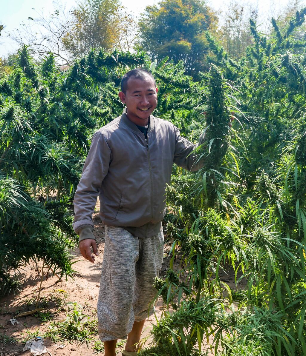
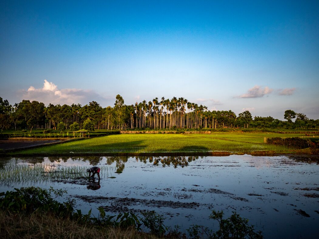
ZOM-THA-PHU-0120250004
Khun Aek Farm General Population 2024 is a domesticate landrace cannabis accession collected by Isabella of the Zomia Collective in Sakhon Nakhon Province, Thailand.
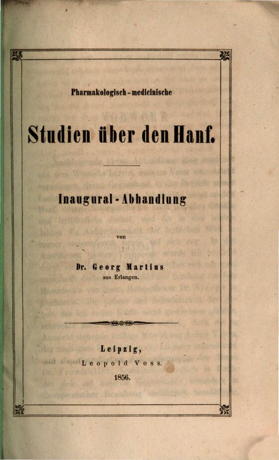
Pharmakologisch-medicinische Studien über den Hanf (1856)
The Pharmakologisch-medicinische Studien über den Hanf ("Pharmacological-Medical Studies on Hemp") is the inaugural dissertation of Dr. Georg Martius of Erlangen, published in Leipzig by Leopold Voss in 1856. The work surveys the hemp plant across four domains: history, botany, pharmacognosy and chemistry. It includes a chronological bibliography of approximately 200 pre-1856 references on cannabis spanning three centuries and is one of the earliest German academic works to treat the subject systematically.
On the question of whether Indian hemp constitutes a separate species, Martius sides with Kaempfer, Willdenow and Roxburgh against Lamarck. He synthesises Alexander Christison's 1849–1851 Edinburgh grow-out experiments, which produced taller plants with narrower leaf segments but no visible resin, to argue that resin production reflects climatic expression rather than fixed botanical distinction.
The dissertation was partly enabled by a shipment of fresh hashish from Dr. Steege, a court pharmacist (Hofapotheker) in Bucharest. Martius also acknowledges Prof. von Gorup-Besanez for supervising the chemical work and Prof. Schnizlein for botanical guidance. read more →
Encyclopedia
Latest reporting
Latest publications
Cannabis eradications


We are witnessing the rapid disappearance of traditional cultivation knowledge and genetic diversity in cannabis. These landrace populations represent thousands of years of natural and human selection, containing unique genetic traits and chemical profiles. Systematic documentation and conservation efforts can serve as a bridge, preserving irreplaceable genetic heritage while supporting traditional communities and advancing our understanding of this remarkable plant.
Recent updates
List of abbreviations:
- N
- This edit created a new page (also see list of new pages)
- m
- This is a minor edit
- b
- This edit was performed by a bot
- (±123)
- The page size changed by this number of bytes
30 July 2026
| 05:06 | User creation log User account CamillaPenningto talk contribs was created | ||||