
Ketama
From Landrace.wiki
More actions
Stub
This page is incomplete. Add sources and expand it.
| Ketama | |
|---|---|
| ActiveCannabis last recorded here in 2023 | |

| |
| Hills around Ketama | |
| Hierarchy | |
| Growing Region | Rif Mountains |
| Geography | |
| Country | Morocco |
| Climate | |
| Climate Type | Mediterranean (mountain) |
| Köppen class (computed) | Csa (temperate, dry summer, hot summer) |
| Elevation (computed) | 1,270 m (786–1,531 m) |
| Closest climate matches | Beni Ahmed Imoukzan (appellation) – 90 Beqaa Valley – 82 Chefchaouen – 81 Beni Bounsar (appellation) – 80 Targuist – 79 |
| Computed from CHELSA V2.1 (1981–2010), the Köppen–Geiger map of Beck et al. (1991–2020) and GMTED2010 (1 km) · About these figures | |
| Growing history | |
| Dated accessions | 1970–2023 |
| Documentation | |
| Appellations | 5 |
| Accessions | 49 |
| Conservation | |
| Populations | none documented yet |
| Seed held in gene banks | 44 accessions (INRA Maroc 44) |
- Point
- 34.83° N, 4.60° W
- Elevation used
- 1,270 m (786–1,531 m) computed, GMTED2010 (1 km), its whole area
- Köppen class
- Csa
- Clock
- UTC+1 (UTC+0 during Ramadan, not shown)
| Month | Jan | Feb | Mar | Apr | May | Jun | Jul | Aug | Sep | Oct | Nov | Dec |
|---|---|---|---|---|---|---|---|---|---|---|---|---|
| Day and night | ||||||||||||
| First light | 07:58 | 07:39 | 07:05 | 06:21 | 05:47 | 05:35 | 05:47 | 06:12 | 06:35 | 06:58 | 07:26 | 07:51 |
| Sunrise | 08:25 | 08:05 | 07:30 | 06:47 | 06:15 | 06:04 | 06:16 | 06:39 | 07:01 | 07:23 | 07:53 | 08:19 |
| Sunset | 18:29 | 19:01 | 19:26 | 19:50 | 20:14 | 20:33 | 20:33 | 20:08 | 19:26 | 18:44 | 18:14 | 18:09 |
| Last light | 18:57 | 19:26 | 19:51 | 20:16 | 20:42 | 21:03 | 21:02 | 20:35 | 19:52 | 19:10 | 18:41 | 18:37 |
| Daylighth | 10h04 | 10h56 | 11h56 | 13h03 | 13h58 | 14h29 | 14h17 | 13h29 | 12h26 | 11h21 | 10h22 | 9h50 |
| Changemin/day | +1.2 | +2.0 | +2.2 | +2.1 | +1.5 | +0.3 | −1.1 | −1.9 | −2.2 | −2.1 | −1.6 | −0.4 |
| Temperature | ||||||||||||
| Avg daily high°C | 10 | 12 | 15 | 16 | 19 | 25 | 29 | 29 | 25 | 20 | 14 | 11 |
| Avg daily low°C | 1 | 2 | 3 | 4 | 8 | 12 | 15 | 15 | 12 | 9 | 5 | 2 |
| Swing°C | 10 | 10 | 11 | 11 | 12 | 13 | 14 | 14 | 12 | 11 | 9 | 9 |
| Water and light | ||||||||||||
| Rainmm | 118 | 104 | 84 | 97 | 43 | 12 | 4 | 6 | 21 | 74 | 143 | 193 |
| VPDkPa | 0.4 | 0.4 | 0.5 | 0.5 | 0.7 | 1.0 | 1.4 | 1.3 | 1.0 | 0.7 | 0.5 | 0.4 |
| Sunlightmol/m²/d | 23 | 29 | 39 | 45 | 50 | 56 | 57 | 53 | 43 | 33 | 24 | 20 |
| Field cycle | ||||||||||||
| Cycle | ||||||||||||
- Planting
- Growing
- Harvest
- Not recorded / off season
From the 2 accessions in this growing area that record a cycle; both give harvest August–September. Neither records planting.
Day and night computed from the sun's position on the 15th of each month; climate normals 1981–2010 from CHELSA V2.1 · About these figures
Ketama (Arabic: Katāma; also Ktama or, after the village at its administrative centre, Issaguen) is a town and traditional kif growing area in the central Rif Mountains of northern Morocco. Long associated with the production of Moroccan hashish, the Ketama landscape sits at the heart of the country's hashish economy and has lent its name to one of the most widely traded categories of North African resin.[1]
Geography
Stub
This section is incomplete. Add sources and expand it.
Climate
Stub
This section is incomplete. Add sources and expand it.
Cultivation History
Stub
This section is incomplete. Add sources and expand it.
Plants
Stub
This section is incomplete. Add sources and expand it.
Cultivation Practices
Stub
This section is incomplete. Add sources and expand it.
Processing
Stub
This section is incomplete. Add sources and expand it.
Conservation Status
Stub
This section is incomplete. Add sources and expand it.
Appellations
| Appellation | Status |
|---|---|
| Abdelghaya Souahel (appellation) | Active |
| Beni Bouchibet (appellation) | Active |
| Issaguen (appellation) | Active |
| Ketama (appellation) | Active |
| Moulay Ahmed Cherif (appellation) | Active |
Accessions
Gallery
-
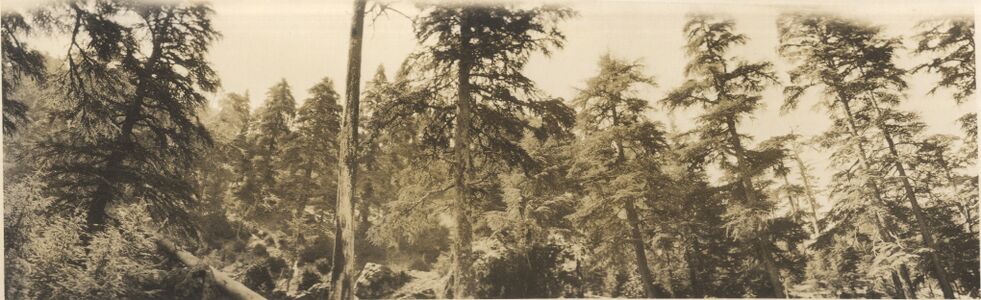 Pine forest at Ketama in a Spanish army photograph of 1925 (Archivo General Militar de Madrid / Biblioteca Virtual de Defensa).
-
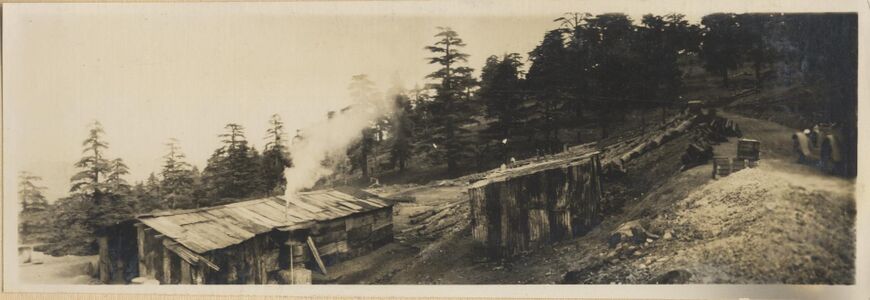 Huts among pines at Ketama, 1925 (Archivo General Militar de Madrid / Biblioteca Virtual de Defensa).
-
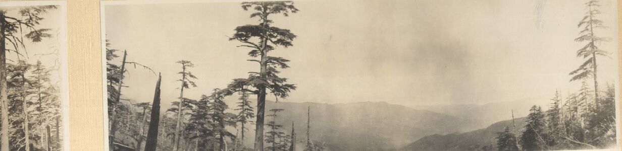 Pine-covered hills at Ketama, 1925 (Archivo General Militar de Madrid / Biblioteca Virtual de Defensa).


See Also
References
- ↑ Chouvy, Pierre-Arnaud and Kenza Afsahi (2014). "Hashish revival in Morocco." International Journal of Drug Policy 25(3): 416–423.