
Category:CC-BY-SA-3.0 licensed files
Category page
More actions
Files published under the Creative Commons Attribution-ShareAlike 3.0 Unported licence (CC BY-SA 3.0). They are tagged with {{CC-BY-SA-3.0}}, and each file description names the author and links the source.
Media in category "CC-BY-SA-3.0 licensed files"
The following 39 files are in this category, out of 39 total.
-
 Altai-Krai-growing-region-Ust-Kalmansky-District-Altai-Krai-Russia-panoramio.jpg 2,048 × 1,536; 782 KB
-
 Angul-River-Mahanadi-near-Tikarpada.jpg 2,048 × 1,536; 349 KB
-
 Bang-Saphan-Thong-Chai-Bang-Saphan-District-Prachuap-Khiri-Khan-Thailand-panoramio.jpg 2,048 × 1,536; 523 KB
-
 Bhopawar-Scene-on-way-of-pitol-to-ranapur-madhya-pradesh.jpg 2,048 × 1,536; 865 KB
-
 Bortala-panoramio.jpg 2,048 × 1,536; 569 KB
-
 Cordillera-Central-Colombia-Cerros-los-Abichuchos-Ortega-Tolima-Colombia-panoramio.jpg 2,048 × 1,536; 479 KB
-
 Deqen-panoramio.jpg 2,047 × 1,168; 837 KB
-
 Doi-Chiang-Dao-Doi-Chiang-Dao-in-the-clouds.jpg 2,048 × 1,067; 565 KB
-
 Eastern-Ghats-Deomali-by-Santanu-Mahapatra-Koraput-panoramio.jpg 1,600 × 1,200; 888 KB
-
 Eastern-Mongolia-OnonRiver.jpg 2,048 × 871; 573 KB
-
 Eastern-Thailand-Pluang-Thong-Bo-Thong-District-Chon-Buri-20270-Thailand-panoramio.jpg 2,048 × 1,536; 510 KB
-
 Gyalrong-Danba-Garze-Sichuan-China-panoramio-6.jpg 1,936 × 1,296; 1.32 MB
-
 Ili-Valley-panoramio.jpg 2,048 × 1,536; 1.38 MB
-
 Ishim-steppe-Russia-River-Ishim-Siberia-panoramio.jpg 2,048 × 1,154; 632 KB
-
 Johar-Valley-GoriValley.jpg 2,048 × 1,536; 745 KB
-
 Kachin-Hills-Myitkyina-Myanmar-Burma-panoramio-53.jpg 2,048 × 1,536; 573 KB
-
 Kaeng-phet-mu-Chiang-Mai-2010.jpg 1,920 × 1,306; 1.77 MB
-
 Kandahar-View-of-Arghandab-Valley.jpg 2,048 × 1,536; 568 KB
-
 Kham-Kangding-Garze-Sichuan-China-panoramio-1.jpg 2,048 × 1,225; 375 KB
-
 Ko-Tao-Am-Strand-von-Ko-Tao.jpg 2,048 × 1,536; 606 KB
-
 Kohistan-Khyber-Pakhtunkhwa-Pallas-valley.jpg 2,048 × 1,536; 936 KB
-
 Kongpo-Bayi-Nyingchi-Tibet-China-panoramio-55.jpg 2,048 × 1,536; 608 KB
-
 Kopi-ganja-Kahwa-1.jpg 1,420 × 1,189; 224 KB
-
 Lake-Victoria-basin-HomaBay.jpg 2,048 × 1,536; 704 KB
-
 Lower-Kohistan-Sharakot-Valley-1.jpg 2,048 × 1,536; 954 KB
-
 Mizo-Hills-Reiek.jpg 2,048 × 1,536; 839 KB
-
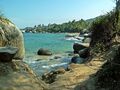 Northern-Colombia-124-Tayrona-National-Park-Colombia.jpg 2,048 × 1,536; 1.12 MB
-
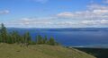 Northern-Mongolia-BlueHovsgol.jpg 2,048 × 1,117; 376 KB
-
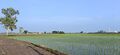 Punjab-submontane-belt-Paddy-fields-in-Batala-Gurdaspur-Punjab.jpg 2,048 × 932; 440 KB
-
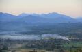 Shan-Hills-Hsipaw-Thibaw-and-around-09.jpg 2,048 × 1,289; 270 KB
-
 Si-Sawat-panoramio.jpg 2,048 × 1,365; 582 KB
-
 Sierra-Madre-Occidental-Rio-Fuerte-panoramio.jpg 2,048 × 1,365; 1.24 MB
-
 Southeastern-Tibet-panoramio.jpg 2,048 × 1,365; 544 KB
-
 Southern-Afghanistan-Mountain-and-Town-panoramio.jpg 2,048 × 1,536; 515 KB
-
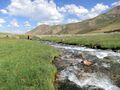 Tian-Shan-growing-region-Telek-Valley-Kochor-District-Kyrgyzstan-panoramio-1.jpg 2,048 × 1,538; 904 KB
-
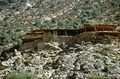 Upper-Kohistan-PkDasu2.jpg 2,048 × 1,355; 1.06 MB
-
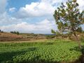 Weining-panoramio.jpg 2,048 × 1,536; 883 KB
-
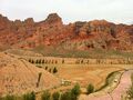 Xining-panoramio-28.jpg 2,048 × 1,530; 959 KB
-
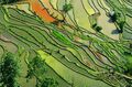 Yunnan-Subsistent-Farming-Southern-China.jpg 2,048 × 1,345; 1.52 MB


