
File:Mpondoland-PSJ-Umzimvubu-River-mouth-seen-from-Port-St-Johns-airfield-South-Africa-2017.jpg
File on Landrace.wiki
More actions
Size of this preview: 800 × 531 pixels. Other resolution: 2,048 × 1,360 pixels.
Original file (2,048 × 1,360 pixels, file size: 666 KB, MIME type: image/jpeg)
Summary
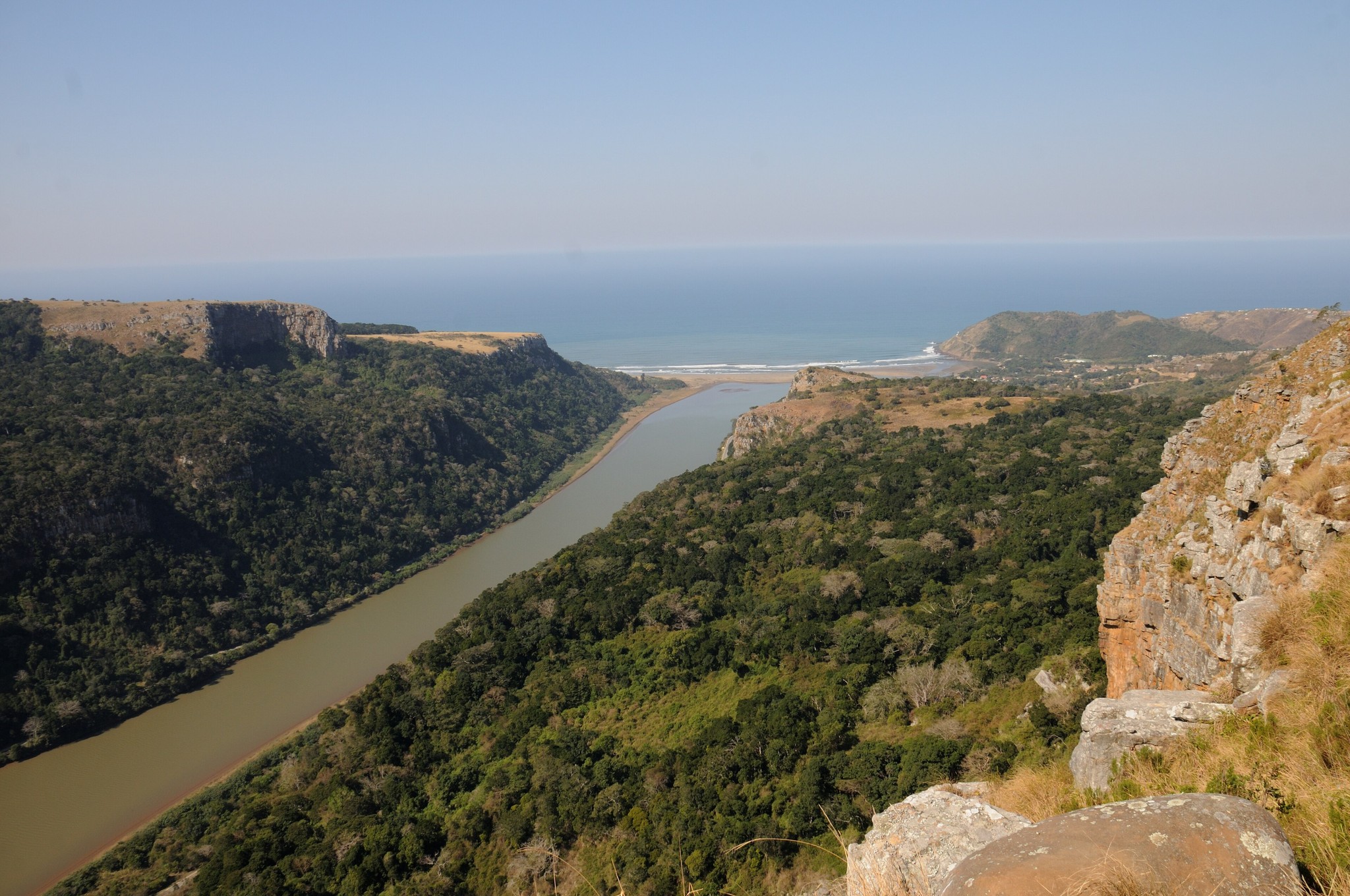
View from the airfield above Port St Johns down the forested gorge of the Umzimvubu River to its mouth, Wild Coast, Eastern Cape, South Africa.
Used as the infobox photograph of Mpondoland.
Source
- Original: "PSJ - Umzimvubu River mouth seen from Port St Johns airfield, South Africa, 2017.jpg", photograph by Josep M. Gracia, 2017-08, on Wikimedia Commons.
- Changes: scaled down from 4288 × 2848 to 2048 × 1360 pixels; no other change.
- Location: The Commons title and description name the Umzimvubu River mouth and Port St Johns, seen from the town's airfield; Port St Johns is one of the two centres of Eastern Mpondoland, and the file's coordinates (-31.6288, 29.5369) are on the hill above the town.

Licensing

Creative Commons Attribution-ShareAlike 4.0 International
This file is licensed under the CC BY-SA 4.0 license.
You are free to: Share and adapt for any purpose, even commercially.
You must: Give appropriate credit, indicate changes, and distribute adaptations under the same license.
File history
Click on a date/time to view the file as it appeared at that time.
| Date/Time | Thumbnail | Dimensions | User | Comment | |
|---|---|---|---|---|---|
| current | 20:06, 29 October 2026 | | 2,048 × 1,360 (666 KB) | Eloise Zomia (talk | contribs) | Photograph of Mpondoland, from Wikimedia Commons (CC BY-SA 4.0) |
You cannot overwrite this file.
File usage
The following 5 pages use this file:
