
File:Journal-of-a-Tour-in-Marocco-and-the-Great-Atlas-1878-South-Marocco-map-1878-eastern-sheet-pfold-out.jpg
File on Landrace.wiki
More actions
Size of this preview: 457 × 599 pixels. Other resolution: 1,562 × 2,048 pixels.
Original file (1,562 × 2,048 pixels, file size: 1.32 MB, MIME type: image/jpeg)
Summary
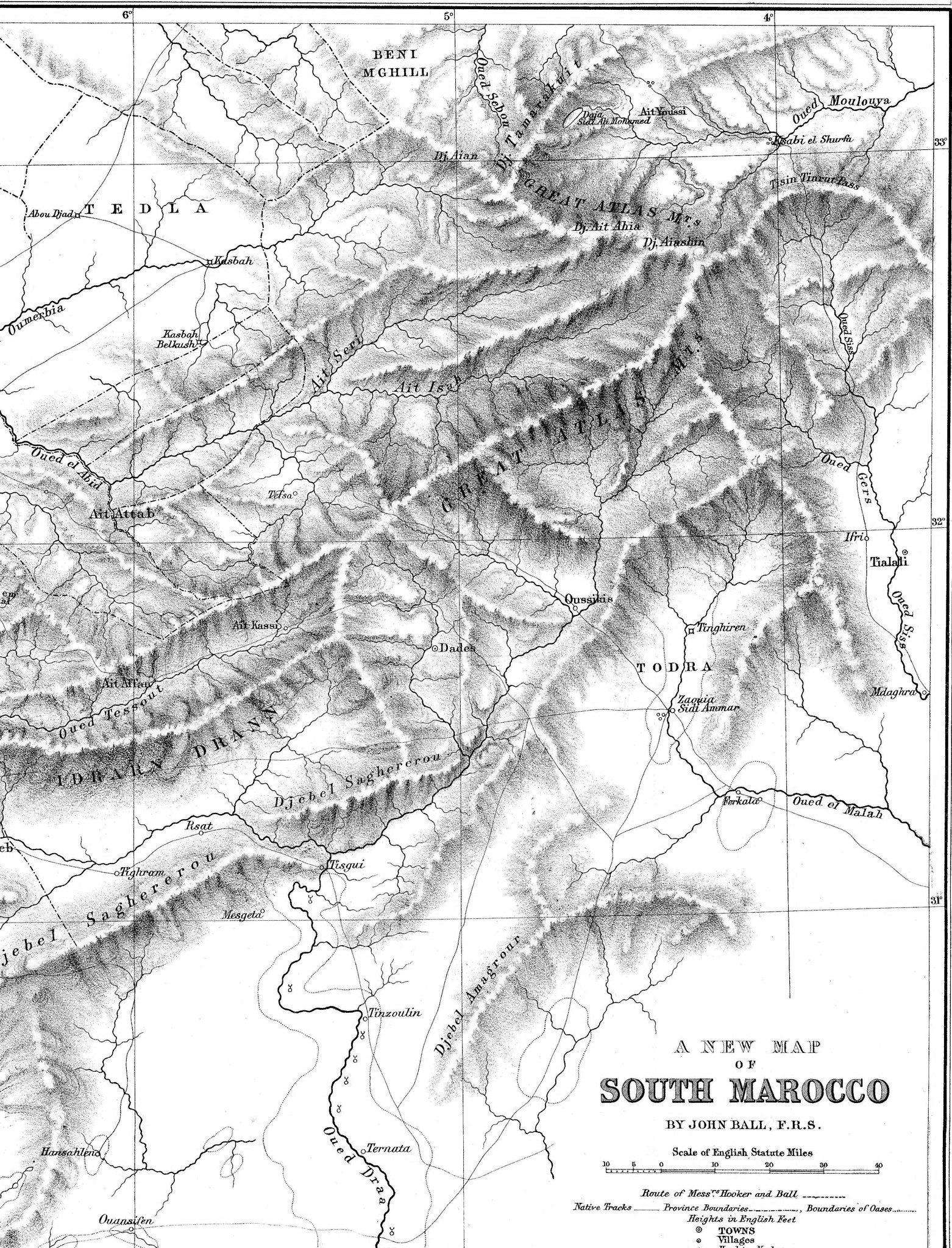
The eastern sheet of the fold-out map A New Map of South Marocco by John Ball, from Joseph Dalton Hooker and John Ball, Journal of a Tour in Marocco and the Great Atlas (London: Macmillan, 1878), scanned by the Internet Archive.
Source
- Original: fold-out map "A New Map of South Marocco" by John Ball, in Joseph Dalton Hooker and John Ball, Journal of a Tour in Marocco and the Great Atlas (London: Macmillan, 1878), as scanned by the Internet Archive and held on Wikimedia Commons.
- Changes: the black scanner strip along the bottom edge was cropped off; tones not adjusted.

Licensing
PUBLIC DOMAIN
Public domain: copyright has expired
This work is in the public domain because its copyright has expired. Published in London in 1878, before 1931.
You are free to: Copy, modify and distribute the work, even for commercial purposes, without asking permission.
Check before reuse: Copyright terms differ between countries, and a photograph or scan of the work can carry its own terms. See the source given in the file description.
File history
Click on a date/time to view the file as it appeared at that time.
| Date/Time | Thumbnail | Dimensions | User | Comment | |
|---|---|---|---|---|---|
| current | 01:34, 31 October 2026 | | 1,562 × 2,048 (1.32 MB) | Eloise Zomia (talk | contribs) | Image for Journal of a Tour in Marocco and the Great Atlas: crop of South Marocco map 1878 eastern sheet, p. fold-out map (public domain) |
You cannot overwrite this file.

