File:West-Bengal-rainfall-map.jpg
File on Landrace.Wiki - The Landrace Cannabis Wiki
More actions
Size of this preview: 424 × 599 pixels. Other resolution: 474 × 670 pixels.
Original file (474 × 670 pixels, file size: 57 KB, MIME type: image/jpeg)
Summary
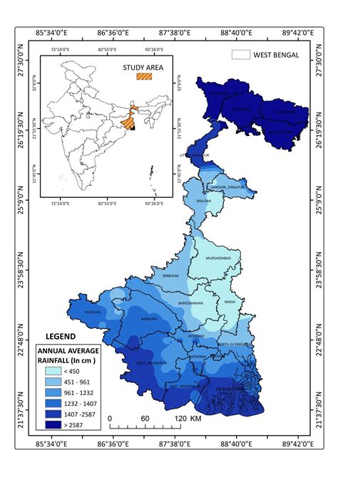
Map showing the annual average rainfall distribution (2023) of West Bengal. The highest rainfall is 2587mm and the lowest rainfall 450mm.
Licensing
⚠ FAIR USE
Fair Use Material
This file may be copyrighted and is used under fair use provisions for:
- News reporting and documentation
- Commentary and criticism
- Educational purposes
- Research and scholarship
Important: Fair use rationale must be provided in the file description. This file should not be reused outside this context without permission from the copyright holder.
File history
Click on a date/time to view the file as it appeared at that time.
| Date/Time | Thumbnail | Dimensions | User | Comment | |
|---|---|---|---|---|---|
| current | 09:08, 22 May 2026 | | 474 × 670 (57 KB) | Eloise Zomia (talk | contribs) | Map showing the annual average rainfall distribution (2023) of West Bengal. The highest rainfall is 2587mm and the lowest rainfall 450mm. |
You cannot overwrite this file.
File usage
The following page uses this file: